Archivio digitale di mappe di Orienteering di Thor Nørskov
|
Accedi
Tutti gli utenti
|
Lingua:
Italiano
Česky
Dansk
Deutsch
Eesti
English
Español
Français
Italiano
Magyar
Norsk
Português
Svenska
Türkçe
|
DOMA 3.0.8
Mostra le scelte di percorso
Nascondi le scelte di percorso
|
Mostra anteprima della carta
Nascondi anteprima della carta
|
KML
|
Indietro
<< Morning thresholdrun (2016-01-14)
|
Regular monday in DK (2016-01-18) >>
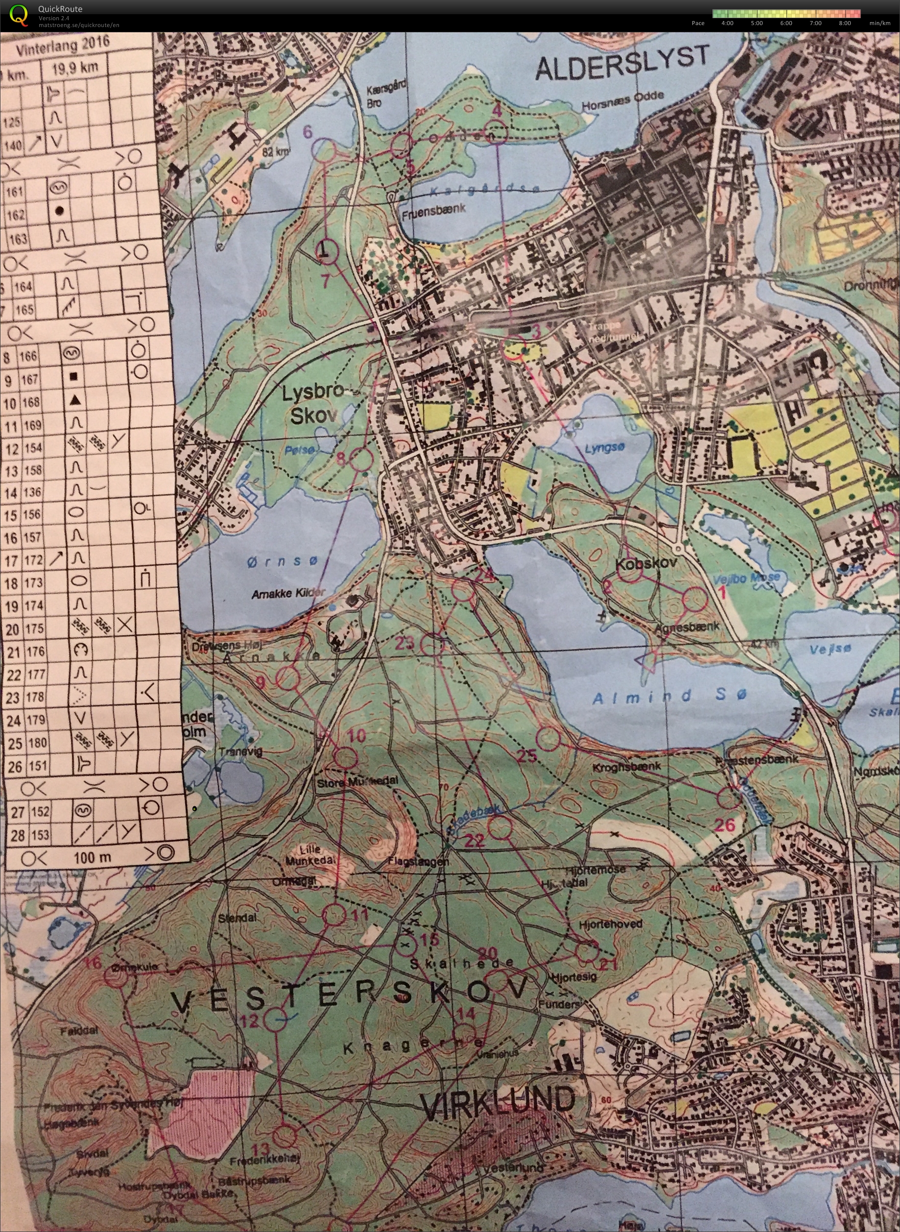
Winterlong (2016-01-17)
Categoria:
Träning
Nome della mappa:
Vesterskoven
Organizzatore:
Silkeborg OK
Paese:
Danmark
Disciplina:
24,11
Risultati
Distanza:
30.61 km
Tempo:
149:58
Time: 2.02.04
Quite a different challenge than the usual orienteering stuff. Ran with Eskil Schøning, Laurits Møller and Simon Grimstrup almost all the way. The track till the 11th was completely off! We went in from the bend but of course missed the control. Then again to number 16 the track kinda disappeared (maybe splitted) and we went a bit wrong. Then I couldn't fit the whole map in... Got pretty tired in the end on this really cold day (-5 to -7 degrees). Actually quite difficult when you're used to way more details and with this you never know how good the runnability will be - dense or open forrest.
Visualizza commenti
Nascondi commenti
(
0
)
Pubblica il nuovo commento
Nome:
Email:
Salva
 Italiano
 Česky
Česky Dansk
Dansk Deutsch
 Eesti
Eesti English
 Español
 Français
 Magyar
 Norsk
Norsk Português
 Svenska
 Türkçe