Arquivo digital de mapas de orientação de Thor Nørskov
|
Log in
Todos utilizadores
|
Língua:
Português
Česky
Dansk
Deutsch
Eesti
English
Español
Français
Italiano
Magyar
Norsk
Português
Svenska
Türkçe
|
DOMA 3.0.8
Mostrar escolhas de percursos
Esconder escolhas de percursos
|
Mostrar mapa geral
Esconder mapa geral
|
KML
|
Voltar
<< First sprint in like a year (26-03-2016)
|
Control picking (29-03-2016) >>
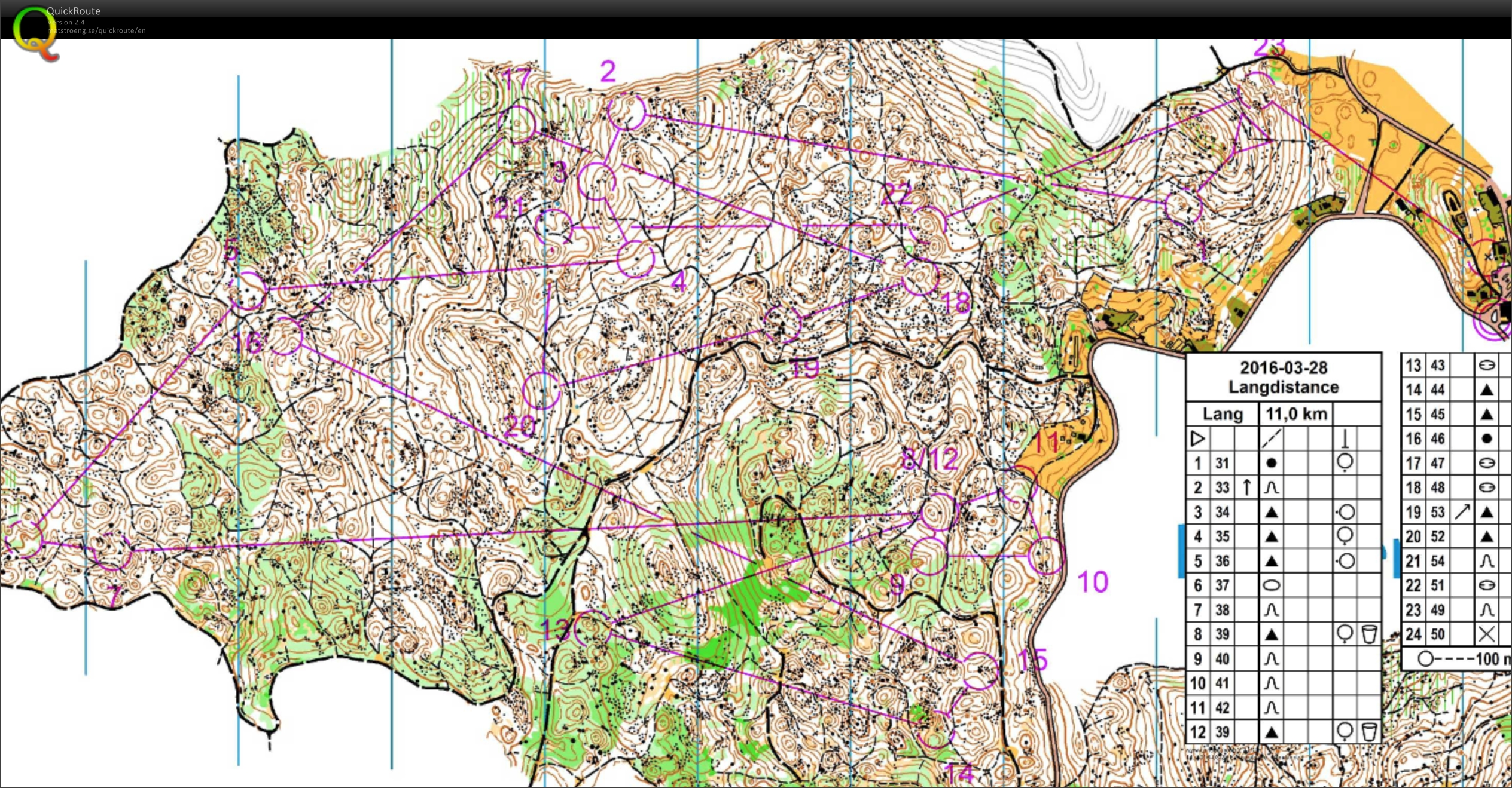
Longdistance in Lokve (28-03-2016)
Categoria:
Träning
Mapa/Área:
Lokve
Organisação:
The Danish National Team
País:
Slovenia
Disciplina:
Long
Distância:
10.52 km
Tempo:
62:20
Time: 42:09
Wasn't allowed to do the whole course yet as still testing the calf. I went fine! Felt a bit unsure in the stony terrain the first 15-20 minutes going fast. But then I started to get the flow feeling back. Really nice to back in my enviroment!
Mostrar comentários
Esconder comentários
(
0
)
Criar novo comentário
Nome:
Email:
Guardar
 Português
 Česky
Česky Dansk
Dansk Deutsch
 Eesti
Eesti English
 Español
 Français
 Italiano
 Magyar
 Norsk
Norsk Svenska
 Türkçe